Quilotoa Crater Lake: Ecuador’s Most Breathtaking Natural Wonder in 2026
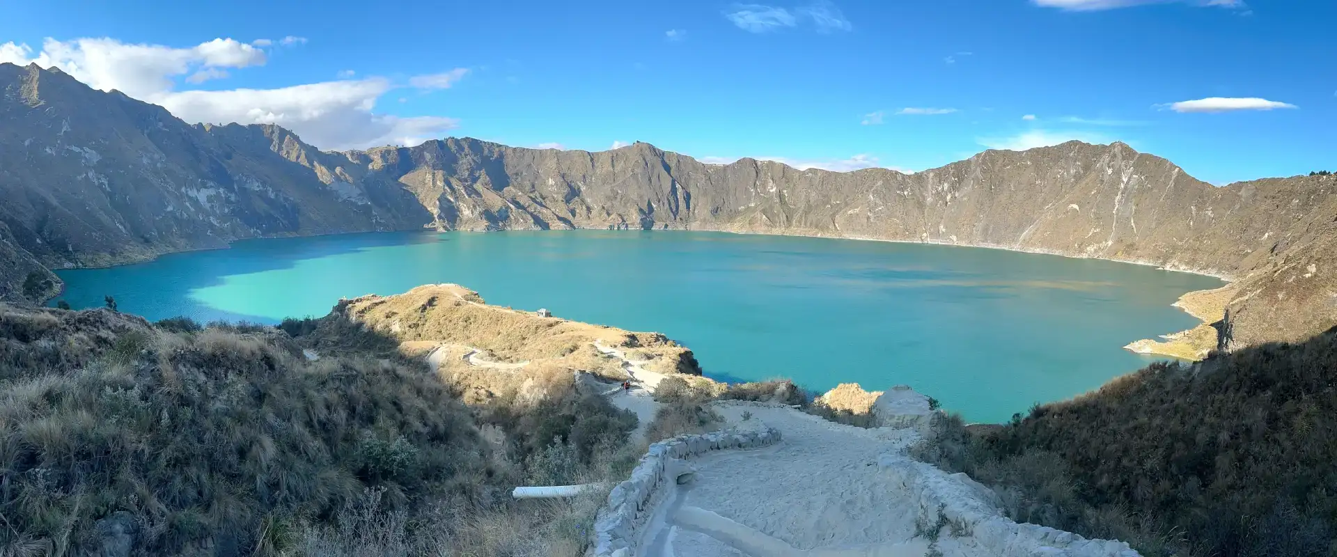
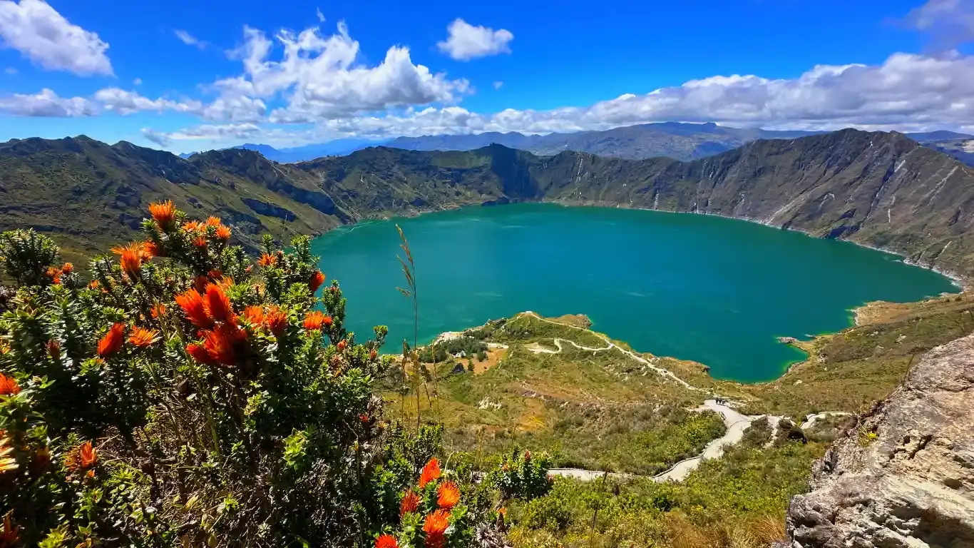
Quilotoa is an active volcanic crater lake in Ecuador located about 3 hours southwest of Quito. The crater holds a turquoise-colored lake at 3,914m elevation. Quilotoa formed roughly 800 years ago from a major pyroclastic eruption. The lake’s distinctive turquoise color comes from dissolved minerals (sulfur, silica) in the acidic volcanic water. You can hike around the crater rim (12 km), descend to the lake (4-5 hours round trip), or take a kayak on the water. It’s a full-day or overnight trip from Quito and costs $40–$100+ depending on tours vs. self-guided options.
I’ve been to Quilotoa maybe thirty times now—once for the sunrise, three times for the hiking, a couple times just to sit and stare. And every single visit, I learn something new about the geology. Honestly, that’s why I keep going back. Quilotoa isn’t just a pretty crater lake sitting in the mountains. It’s a window into how this part of Ecuador was violently reshaped just eight centuries ago.
In this guide, I’m going to break down the Quilotoa crater lake geology, explain why the water looks that way, how it formed, and what the geology tells us about the danger (or lack thereof) if you’re planning a visit. Because once you understand what you’re looking at, Quilotoa becomes even more fascinating.
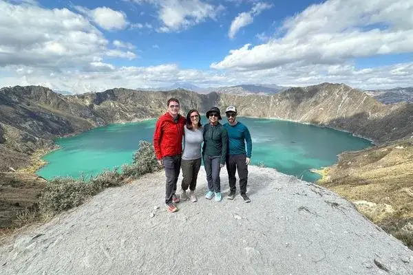
How Did Quilotoa Form? The Eruption of 1280
Quilotoa wasn’t always a lake. It was a volcano. Like many of Ecuador’s 84 volcanoes, Quilotoa is part of the larger Ecuadorian volcanic arc—a chain of over 20 active and dormant volcanoes running north to south through the country. Quilotoa sits in the Western Cordillera, the chain of mountains on Ecuador’s western flank.
Around 1280 CE (give or take a few decades, geologists are still debating the exact year), Quilotoa erupted catastrophically. This wasn’t a slow lava flow. This was a massive pyroclastic eruption—the kind where the volcano explodes violently, ejects hot ash, rock, and gas at extreme velocities, and fundamentally changes the landscape. Geologists estimate the eruption ejected roughly 21 cubic kilometers of material. For perspective, that’s about 8 times the volume of Mount St. Helens’ 1980 eruption in Washington. Not sure where this fits in your itinerary? Send us your dates and we will sort the order out.
The eruption column shot ash and pumice thousands of meters into the atmosphere. The pyroclastic flows—superheated clouds of ash, rock, and gas moving at hurricane speeds—raced down the volcano’s flanks, incinerating everything. When the eruption finished, the volcano’s internal magma chamber was depleted. The structure above it collapsed, creating a massive depression: the caldera (crater).
Over the following centuries, rainwater accumulated in the crater, forming the lake we see today. The process was gradual—it took decades or maybe a century for the lake to reach its current level—but eventually, you had a crater lake.
Why Is Quilotoa Lake That Color?
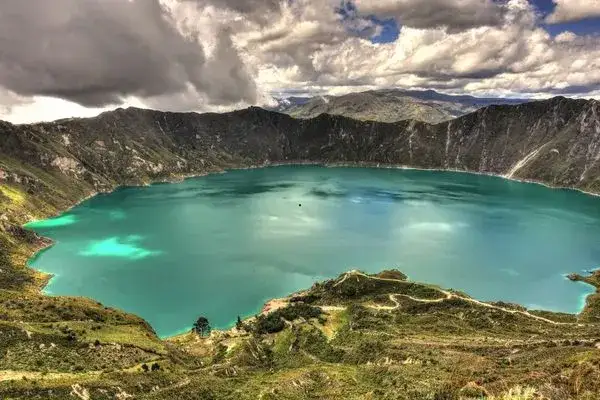
When people ask about Quilotoa, the second question is always: “Why is the water so turquoise?” It looks almost unreal—electric turquoise, sometimes with hints of green. It’s not algae. It’s not dye. It’s geology.
The water in Quilotoa lake is highly acidic. The pH is around 1.8 to 2.5—for context, lemon juice is about 2.0. That level of acidity is created by volcanic gases, especially sulfur dioxide and hydrogen sulfide, that are still being released from the crater floor. These gases dissolve into the water, creating sulfuric acid.
In that acidic environment, fine particles of minerals—silica, sulfur compounds, and other dissolved volcanic minerals—stay suspended in the water instead of settling to the bottom. These suspended particles scatter and reflect light in a way that produces the distinctive turquoise color. The color can change throughout the day depending on lighting and how much volcanic activity is occurring.
The same mineral content makes the lake toxic for most wildlife, which is why you won’t see fish or plants living in it. The lake is essentially a giant cup of weak sulfuric acid.
Is Quilotoa Still Active? Is It Dangerous?
Yes, Quilotoa is technically active. No, it’s not dangerous for visitors (with basic precautions).
The volcano is classified as “active” because there’s still volcanic activity happening—gas emissions from the crater floor, minor seismic activity, and changes in the lake’s chemical composition. In 2015, the Ecuadorian government reported increased gas emissions and raised the alert level temporarily. But this kind of activity has been ongoing for centuries.
The real hazards at Quilotoa are environmental, not volcanic:
- Altitude: At 3,914m, the lake is high enough that altitude sickness is possible, especially if you’re not acclimated.
- The acidic water: Don’t drink it, don’t swim in it, and if you take a kayak, don’t fall in.
- Hiking exposure: The rim trail has steep drop-offs. Stay on the marked trail.
- Weather: Mountain weather changes fast. Bring layers.
Major eruptions from Quilotoa? Not expected anytime soon. Geologists estimate the next major eruption might not happen for hundreds or thousands of years. For now, Quilotoa is in a stable, post-eruption phase.
START IN QUITO, END IN THE GALÁPAGOS
9 Day Ecuador and Galapagos Tour: Andes, Amazon and Santa Cruz
Quito, Cotopaxi, Quilotoa, Baños and the Amazon with your own guide, then three nights on Santa Cruz with tortoises, beaches and snorkeling.
From $1,990 per person
View itineraryPair It With the Galápagos: 9 Day Ecuador & Galápagos Tour
Visiting Quilotoa: What You’re Actually Looking At
Now that you understand the geology, a visit to Quilotoa hits different. You’re not just looking at a pretty lake. You’re looking at:
- A crater created by an explosion 800 years ago that reshaped the landscape
- An acidic lake filled with dissolved volcanic minerals
- An active volcanic system that’s still releasing gases and slowly changing
- One of Ecuador’s most geologically interesting features
If you hike the rim, you’re walking along the edge of the crater itself. If you descend to the lake or kayak on it, you’re on the floor of a volcano that erupted 800 years ago.
That context makes the experience more meaningful.
FAQ — Quilotoa Crater Lake
Looking for more on Quilotoa Crater Lake? Browse our related coverage on quilotoa crater lake ecuador, quilotoa crater lake guide, quilotoa crater lake tour, and reach out to our local experts for personalized planning.
Can you swim in Quilotoa lake?
No — and you really shouldn’t try. The water has a pH around 1.8 to 2.5, which is basically lemon juice levels of acidity from dissolved sulfuric compounds. On top of that, the temperature hovers around 5°C year-round, and the depth drops off to 250 meters almost immediately. I’ve seen tourists dip their hands in, and even that left their skin feeling dry for hours. Swimming is officially prohibited by park authorities.
How deep is Quilotoa crater lake?
The lake reaches an estimated maximum depth of 250 meters (820 feet). What makes it deceptive is how quickly the depth increases — the crater walls plunge steeply underwater, so there’s no gradual shallow zone. The lake formed over centuries as rainwater filled the caldera left by the massive 1280 CE eruption.
How high is Quilotoa? What’s the altitude?
The crater rim sits at 3,914 meters (12,841 feet) above sea level. That’s higher than most people realize — and altitude sickness is a real concern if you haven’t acclimatized. I always tell visitors to spend at least 2-3 days in Quito (2,850m) before making the trip. Drink plenty of water, skip the alcohol the night before, and take it slow on any hiking.
Is the Quilotoa crater hike difficult?
Depends on which hike. Walking to the main viewpoint from the parking lot is flat and takes five minutes — anyone can do it. The descent to the lake shore takes about 30 minutes down on steep, sandy terrain, but climbing back up is the hard part: 1 to 1.5 hours of sustained uphill at high altitude. The full crater rim hike is 12 km and takes 5-6 hours over uneven ground with steep drop-offs. The multi-day Quilotoa Loop trek covers 35-40 km over 2-4 days through remote indigenous villages.
What’s the best time to visit Quilotoa?
June through September gives you the best weather — clearer skies, less rain. But the real tip is about timing your day: get there before 10 AM. Cloud cover rolls in almost every afternoon, and once those clouds settle into the crater, you lose the turquoise water views entirely. I’ve had trips where we arrived at 11 AM and couldn’t see the lake at all. Early morning light also makes the colors pop for photography.
How much does a Quilotoa tour cost from Quito?
Guided day tours from Quito run between $40 and $100 USD per person, depending on group size and what’s included. Budget travelers can do it independently by bus for under $15 round trip — take a bus from Quito’s Quitumbe terminal to Latacunga ($3-4), then a local bus from Latacunga to Quilotoa ($2-3). The Quilotoa National Park entry fee is $2 per person. Mule rides from the lake back to the rim cost about $10 if your legs give out.
Bottom Line
Quilotoa crater lake is geologically fascinating, accessible, and safe for visitors who follow basic precautions. The turquoise color is real geology—dissolved volcanic minerals in acidic water. The crater formed from a catastrophic eruption 800 years ago. The volcano is still technically active, but poses no immediate threat to visitors. And the experience of standing on the crater rim, looking at a landscape literally reshaped by volcanism, is something worth the 3-hour drive from Quito. Quilotoa is just one of Ecuador’s 84 incredible volcanoes — explore our complete guide for more peaks to visit. If you’re into volcano hiking, the Cotopaxi National Park trail and the Avenue of the Volcanoes drive are natural next stops.