Volcanoes in Ecuador: Local Guide to All 84 Peaks
Ecuador Volcanoes — this guide brings together everything you need to know, from local recommendations to practical travel tips. We cover ecuador volcanoes guide and ecuador volcanoes tour so you can plan with confidence.
Volcanoes in Ecuador number 84 peaks spanning the Andes highlands and the Galápagos Islands — making this small country one of the most volcanic on Earth. Of these, around 27 remain potentially active, all monitored around the clock by the Instituto Geofisico. The country sits squarely on the Pacific Ring of Fire, where the Nazca Plate pushes beneath the South American Plate — creating one of the densest volcanic corridors anywhere on Earth.
I’ve spent over a decade guiding visitors through this landscape, and the volcanoes still catch me off guard. You’ll be driving the Pan-American Highway south of Quito, coffee in hand, and suddenly Cotopaxi appears through a gap in the clouds — perfect cone, glaciers catching the morning sun. That never gets old.
This guide covers every volcano in Ecuador: the famous ones you’ve heard of, the active ones that keep geologists busy, and the dozens of extinct peaks most travelers drive right past without knowing. Whether you’re planning a summit attempt or just want to understand what you’re looking at from your hotel window in Quito, it’s all here.
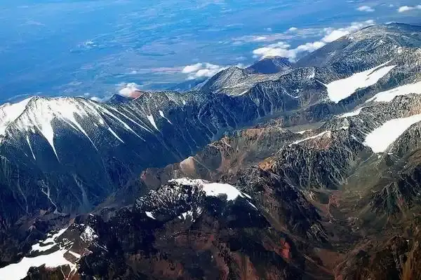
How Many Volcanoes Are in Ecuador?
Ecuador has 84 recognized volcanoes. Roughly 27 are considered potentially active, about 15 are dormant, and the remaining 42 are classified as extinct. The Instituto Geofisico at the Escuela Politecnica Nacional monitors them all from their Quito headquarters.
Those numbers vary depending on who you ask. The Smithsonian Global Volcanism Program lists 36 Holocene volcanoes for Ecuador. The Instituto Geofisico tracks 27 as potentially active. And if you count every volcanic structure — including ancient eroded remnants that barely look like volcanoes anymore — you get to 84.
The reason Ecuador has so many volcanoes packed into such a small country comes down to geology. Two separate volcanic systems operate here simultaneously. Along the Andes, the Nazca Plate subducts beneath the South American Plate, generating the classic stratovolcanoes — Cotopaxi, Chimborazo, Tungurahua. Out in the Pacific, a mantle hotspot feeds the Galapagos shield volcanoes — Wolf, Sierra Negra, Fernandina. Two entirely different volcanic engines, one small country.
| Category | Count | Examples |
|---|---|---|
| Active | ~27 | Cotopaxi, Sangay, Reventador, Wolf |
| Dormant | ~15 | Chimborazo, Imbabura, Cotacachi |
| Extinct | ~42 | Mojanda, Pasochoa, Rumiñahui |
| Total | 84 |
Top 10 Volcanoes in Ecuador You Need to See
Out of 84 volcanoes, these are the ten that define Ecuador’s volcanic identity. Some are famous for their beauty, others for their power, and a few for being genuinely terrifying.
1. Cotopaxi (5,897m) — The Icon
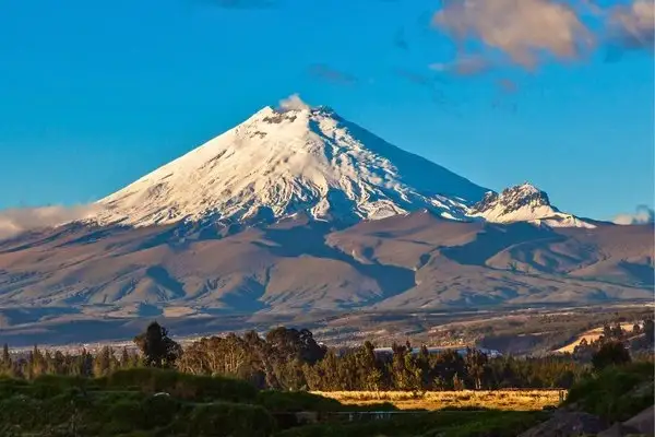
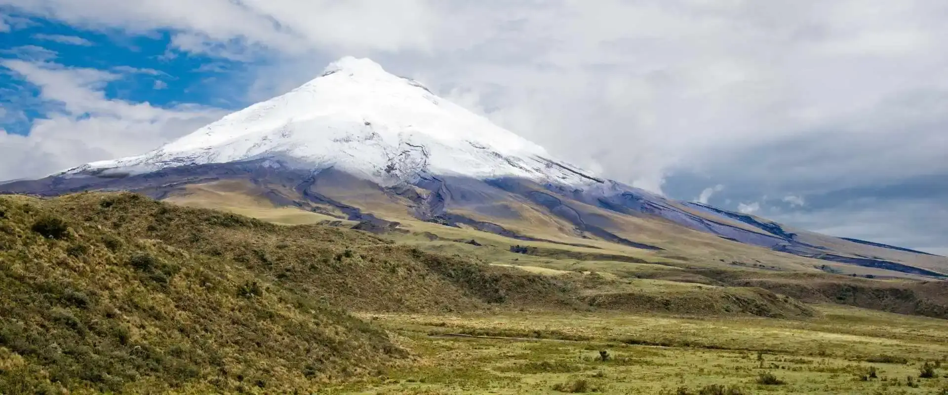
Cotopaxi is the postcard volcano. That symmetrical cone with the glacier cap — you’ve seen it on every Ecuador travel brochure. It sits just 50 km south of Quito, and on clear days you can see it from the capital. The national park surrounding it receives over 200,000 visitors annually. Summit attempts require certified guides and take about 7 hours from the refuge. The park reopened fully in 2017 after the 2015 eruption scare. Many of our Ecuador vacation packages start with a full day in Cotopaxi National Park.
Currently on yellow alert, but hiking and climbing are open. Check our Cotopaxi National Park hiking guide for trail details, or read about the full Cotopaxi volcano hike if you want to reach the glacier. The Jose Rivas Refuge at 4,800m is where climbers spend the night before their summit push.
2. Chimborazo (6,310m) — The Highest Peak
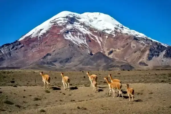
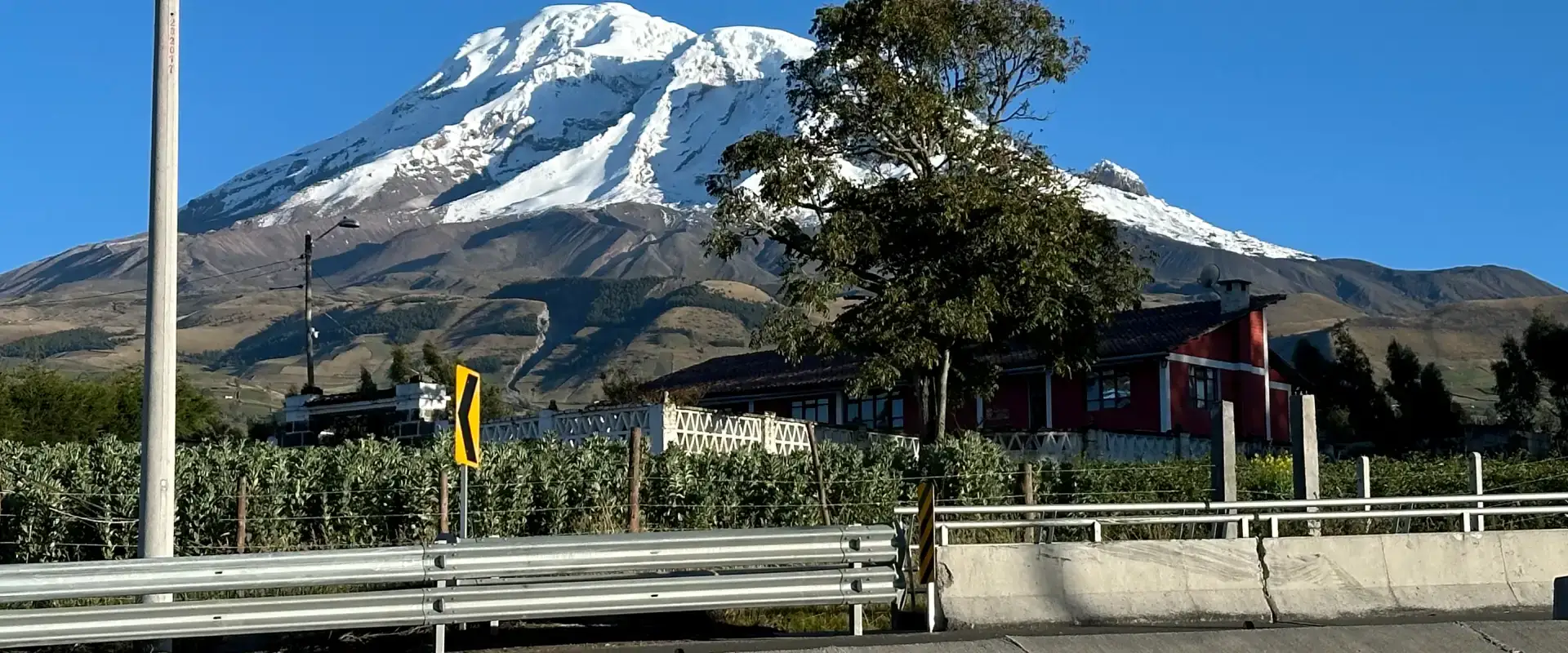
Chimborazo isn’t just Ecuador’s tallest volcano — its summit is the farthest point from Earth’s center. Because our planet bulges at the equator, Chimborazo’s peak sits about 2,168 meters farther from the core than Everest’s summit. That’s the kind of fact that makes geography nerds lose their minds. The mountain last erupted around 550 CE and is considered dormant. Climbing it requires good acclimatization and experience — this isn’t a beginner peak. Our complete Chimborazo guide covers routes, costs, and what to expect. Can’t decide between the two big peaks? The Chimborazo vs. Cotopaxi comparison breaks down the key differences.
3. Tungurahua (5,023m) — The Throat of Fire
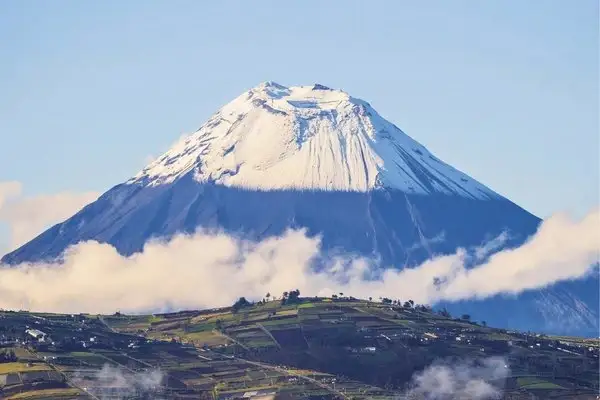
“Tungurahua” means “Throat of Fire” in Kichwa, and it earned that name. It erupted continuously from 1999 to 2016, forcing evacuations of Banos multiple times. I remember the 2006 eruption — pyroclastic flows came down the western flank and you could see the glow from Ambato. Today it’s quiet but monitored 24/7. You can’t climb Tungurahua, but the views from the Banos mirador at Bellavista or the Casa del Arbol swing are stunning. The town sits just 8 km from the crater. Read our full Tungurahua volcano guide for current activity status and what to see around Baños. Not sure how to fit this into a trip? Tell us your dates and we will map it out.
4. Sangay (5,230m) — The Nonstop Eruption
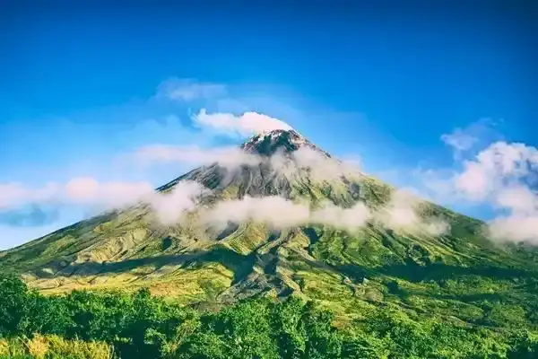
Sangay has been erupting almost continuously since 1934. That’s over 90 years of volcanic activity. It’s one of the most active volcanoes on the planet, yet most travelers have never heard of it. The reason is simple: Sangay sits in a remote national park in the eastern Andes, surrounded by cloud forest. Access is limited and the volcano itself is off-limits. Ash emissions are constant, and nearby communities deal with ashfall regularly. Explore our Sangay National Park guide for trekking routes and how to visit this UNESCO site.
5. Reventador (3,562m) — The Explosive One
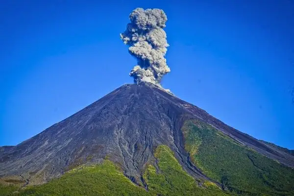
Reventador sits east of Quito in the sub-Andean zone, and it’s been highly active since its major 2002 eruption that sent ash raining on the capital. Frequent explosions, lava flows, and pyroclastic events make it Ecuador’s most consistently dramatic volcano right now. The name means “the exploder” in Spanish. Access is restricted — you can’t visit it, but you can sometimes see the glow from the Quito-Lago Agrio highway at night. Our Reventador volcano guide explains the current eruption, the 2002 event, and the best viewpoints.
6. Cayambe (5,790m) — The Equatorial Glacier
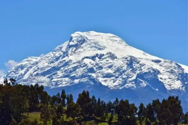
Cayambe holds a unique distinction: its south slope is crossed by the equator, making it the only place on Earth where the equatorial line intersects a glacier. At 5,790m, it’s Ecuador’s third-highest peak. The climbing route is technical — crevasses are a real hazard, and conditions change fast. Cayambe is also a major water source for Quito and the surrounding agricultural communities. Cayambe sits along the stunning Avenue of the Volcanoes — a route worth driving if you want to see multiple peaks in one trip.
7. Antisana (5,753m) — The Remote Giant
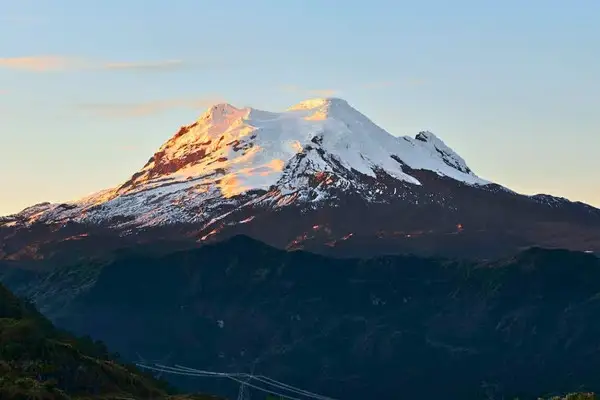
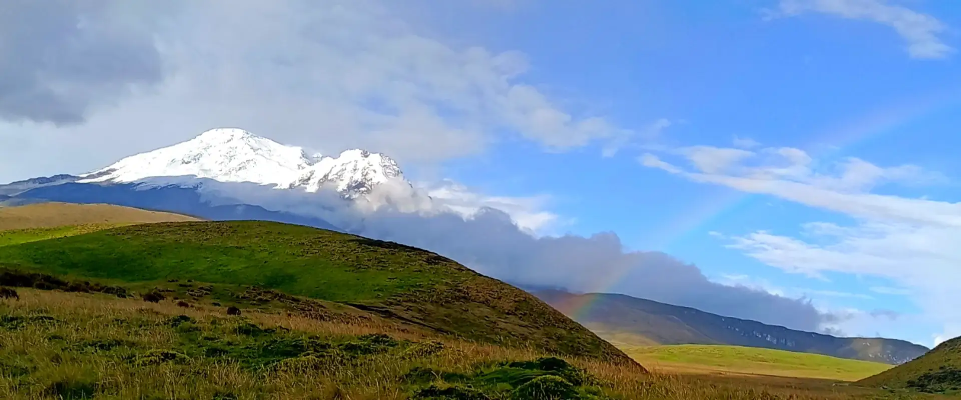
Antisana is one of those volcanoes that most people only see from the highway to the Amazon. It’s massive, heavily glaciated, and notoriously difficult to climb due to unpredictable weather. The ecological reserve around it is one of the best spots near Quito for birdwatching — Andean condors circle the paramo regularly. The volcano last erupted in 1801 and is considered dormant. Our Antisana Ecological Reserve guide covers the best viewpoints and how to arrange a day trip from Quito.
8. Guagua Pichincha (4,784m) — The One Above Quito
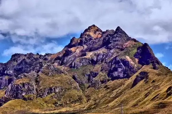
Guagua Pichincha literally looms over Ecuador’s capital. Its last major eruption in 1999 blanketed Quito in ash — I still remember sweeping it off the car. Today it’s quiet, and you can hike to the crater from the Teleferico station. The trail takes about 4-5 hours round trip and offers jaw-dropping views of Quito and, on clear days, Cotopaxi and Cayambe in the distance. The crater itself is massive — a collapsed caldera with steaming fumaroles.
9. Sierra Negra (1,124m) — The Galapagos Giant
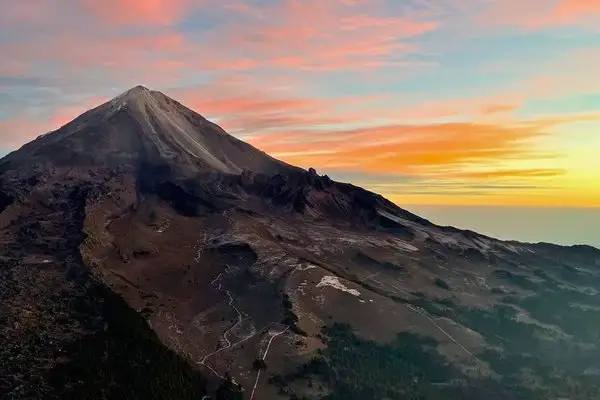
Sierra Negra on Isabela Island has one of the largest calderas in the world — roughly 10 km across. It last erupted in 2018, sending lava flows toward the coast. The caldera rim hike is one of the best things you can do on Isabela. It takes about 3-4 hours round trip, and the views across the caldera are surreal — you feel like you’re on another planet. The trail starts from the highlands above Puerto Villamil.
10. Wolf (1,710m) — The Tallest in Galapagos
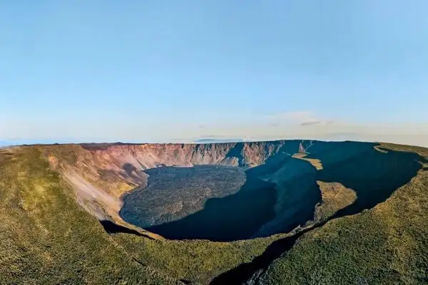
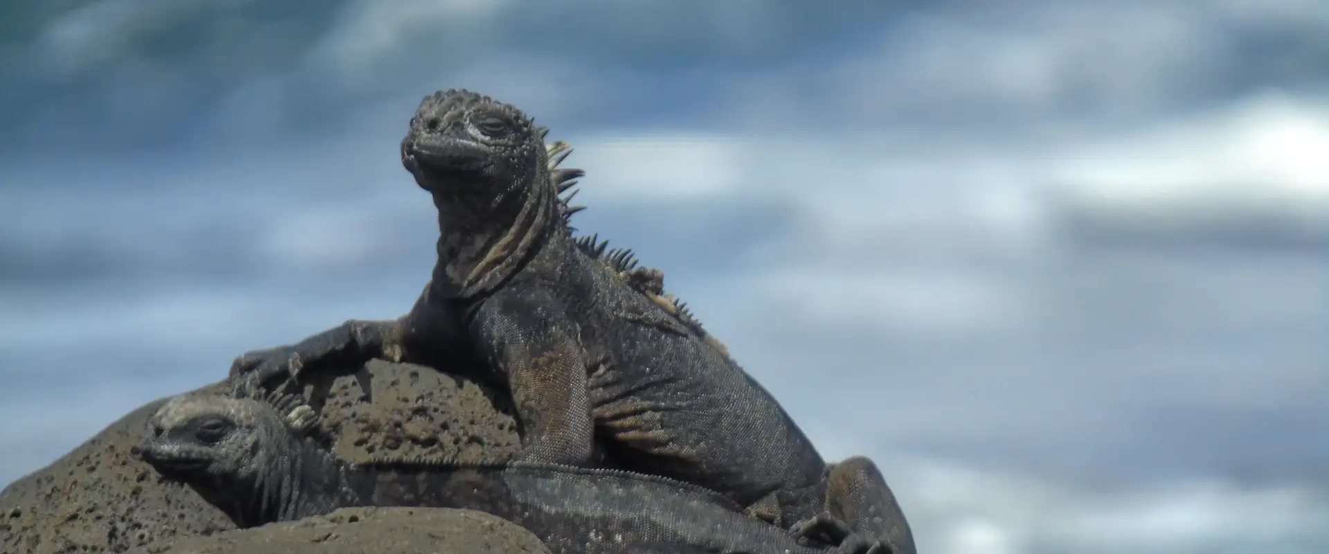
Wolf is the highest point in the Galapagos, sitting on the northern tip of Isabela Island. It erupted in January 2022, sending lava flows down its flanks. The area is home to the only population of pink iguanas on Earth — a species discovered only in 2009. Wolf is remote and not accessible to regular tourists, but it’s a favorite of volcanologists studying hotspot volcanism.
START IN QUITO, END IN THE GALÁPAGOS
9 Day Ecuador and Galapagos Tour: Andes, Amazon and Santa Cruz
Quito, Cotopaxi, Quilotoa, Baños and the Amazon with your own guide, then three nights on Santa Cruz with tortoises, beaches and snorkeling.
From $1,990 per person
View itineraryPair It With the Galápagos: 9 Day Ecuador & Galápagos Tour
Active Volcanoes in Ecuador: Current Status 2026
Around 27 of Ecuador’s 84 volcanoes are potentially active. The Instituto Geofisico monitors them constantly. As of 2026, Sangay and Reventador show ongoing eruptions, while Cotopaxi remains on yellow alert with the park open for visitors.
Here’s where things stand right now with the most closely watched volcanoes:
| Volcano | Alert Level | Last Eruption | Safe to Visit? |
|---|---|---|---|
| Sangay | Yellow | Ongoing since 1934 | No — restricted area |
| Reventador | Orange | Ongoing since 2002 | No — not accessible |
| Cotopaxi | Yellow | 2015 | Yes — park open, summit climbs available |
| Sierra Negra | Green | 2018 | Yes — caldera hike open on Isabela |
| Tungurahua | Green | 2016 | Yes — Banos area fully accessible |
| Guagua Pichincha | Green | 1999 | Yes — crater hike from Teleferico |
| Wolf | Green | 2022 | No — remote, no tourist access |
| Fernandina | Green | 2020 | Limited — Punta Espinoza cruise stop |
The alert system works in four levels: green (normal), yellow (elevated activity), orange (increasing eruption probability), and red (eruption in progress or imminent). The Instituto Geofisico publishes daily reports — worth checking before any volcano trip at igepn.edu.ec.
The Avenue of Volcanoes: Ecuador’s Volcanic Highway
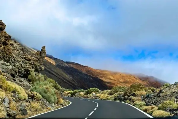
Alexander von Humboldt coined the name “Avenue of Volcanoes” in 1802 when he traveled through Ecuador’s central highlands. The name stuck — and for good reason. Drive the E35 highway south from Quito toward Riobamba, and you’ll pass between two parallel chains of volcanoes on either side of the Inter-Andean Valley.
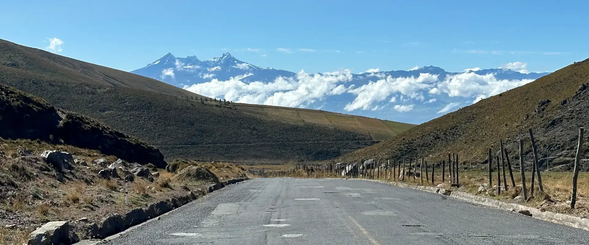
On a clear day — and that’s a big “if” in the highlands — you might see Cotopaxi, Tungurahua, Chimborazo, Altar, and a half-dozen other peaks from the road. The section between Ambato and Riobamba is particularly dramatic. Chimborazo dominates the western horizon while Tungurahua and Altar frame the east.
The best way to experience this corridor is by renting a car or booking a tour. Public buses run the route but don’t stop for photos. From Quito, it’s about 4 hours to Riobamba — but plan a full day if you want to stop at Cotopaxi National Park, the town of Banos, and the viewpoints along the way.
For train lovers, the Tren Ecuador used to run the famous Nariz del Diablo route through the avenue. Service has been intermittent in recent years — check current schedules before planning around it.
Galapagos Volcanoes: Where the Islands Are Still Being Born
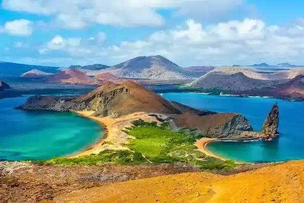
Galapagos volcanism works completely differently from the Andes volcanoes. There’s no subduction here — instead, the islands sit over a mantle hotspot, a plume of magma rising from deep in the Earth. As the Nazca Plate moves east, new islands form over the hotspot while older ones drift away and erode.
Isabela Island alone has five major shield volcanoes: Wolf, Darwin, Alcedo, Sierra Negra, and Cerro Azul. All five are active. Fernandina, the youngest island, is among the most pristine volcanic environments on the planet — no permanent human population, and eruptions reshape the landscape regularly.
The Galapagos volcanoes are shield volcanoes — broad, gently sloping structures built by fluid lava flows. They look nothing like the steep cones of the Andes. Sierra Negra’s caldera is so wide you can barely see the other side from the rim trail.
For visitors, the accessible volcanic experiences are Sierra Negra’s caldera hike on Isabela (half-day, moderate difficulty) and the lava tunnels on Santa Cruz. Cruise itineraries may include landings at Punta Espinoza on Fernandina or Sullivan Bay on Santiago, where recent lava flows create an alien landscape.
Volcano Hiking in Ecuador: What You Actually Need to Know
Ecuador is one of the best countries in the world for volcano hiking — from easy day walks to serious mountaineering expeditions. But altitude is the main challenge. Even the “easy” volcanoes sit above 3,500 meters, and the big summits push past 5,000m. Here’s a realistic breakdown:
| Difficulty | Volcano | Altitude | Time | Notes |
|---|---|---|---|---|
| Easy | Pululahua Crater | 3,356m | 2-3 hrs | Walk into a live crater. Near Quito. |
| Easy | Sierra Negra (Galapagos) | 1,124m | 3-4 hrs | Caldera rim hike on Isabela Island. |
| Moderate | Guagua Pichincha | 4,784m | 4-5 hrs | Crater hike from Teleferico. Altitude hits. |
| Moderate | Rumiñahui | 4,721m | 6-7 hrs | In Cotopaxi park. Steep scramble at top. |
| Challenging | Cotopaxi | 5,897m | 7-8 hrs summit | Glacier climb. Guide + permits required. |
| Mountaineering | Chimborazo | 6,310m | 8-10 hrs summit | Technical. Need prior high-altitude experience. |
| Mountaineering | Cayambe | 5,790m | 7-9 hrs summit | Crevasse danger. Most technical of the big three. |
Altitude acclimatization matters. Don’t fly into Quito (2,850m) and attempt Cotopaxi the next day. Spend at least 3-4 days acclimatizing. Hike Pichincha or Pasochoa first. Drink plenty of water and skip alcohol the first couple days. I’ve seen fit people from sea level turn around at 4,800m because they rushed the acclimatization.
Best season: June through September offers the driest weather in the highlands. December-January is a secondary dry window. The Galapagos volcanoes can be hiked year-round, though January through May is warmer and wetter.
Ecuador Volcano Eruptions: A Timeline of Major Events
Ecuador’s volcanoes aren’t just scenery — they’re active geological forces that have shaped communities, displaced populations, and reshaped landscapes within living memory.
| Year | Volcano | Event |
|---|---|---|
| 1534 | Cotopaxi | Eruption during Spanish conquest; lahars reached the Pacific |
| 1797 | Tungurahua | Major earthquake + eruption; destroyed Riobamba |
| 1877 | Cotopaxi | Largest modern eruption; lahars traveled 100+ km |
| 1999 | Guagua Pichincha | Ash fall covered Quito; airport closed repeatedly |
| 1999-2016 | Tungurahua | 17-year eruption cycle; Banos evacuated multiple times |
| 2002-present | Reventador | Major explosion in 2002; ongoing activity since |
| 2015 | Cotopaxi | Increased activity; park closed then reopened |
| 2018 | Sierra Negra | Lava flows on Isabela; no casualties |
| 2020 | Fernandina | Eruption in uninhabited island; no impact on towns |
| 2022 | Wolf | Lava flows near pink iguana habitat; iguanas unharmed |
The 1877 Cotopaxi eruption remains the benchmark for disaster planning. Lahars — volcanic mudflows — traveled over 100 km, reaching the Pacific coast and the Amazon basin simultaneously. Modern lahar hazard maps show that parts of the Chillos Valley southeast of Quito sit in the potential flow path. That’s where about 300,000 people live today.
Complete List of Volcanoes in Ecuador: All 84 Peaks
Here’s the reference list, organized by region. This includes every recognized volcanic structure — from the massive stratovolcanoes everyone knows to the ancient remnants that only geologists get excited about.
Central Highlands & Avenue of Volcanoes
The backbone of Ecuador’s volcanic landscape. This corridor between Quito and Riobamba contains the country’s most iconic peaks, lined up along two parallel chains of the Andes. Don’t miss Quilotoa Crater Lake — Ecuador’s most stunning natural wonder, with that famous turquoise water filling the caldera. And the full Avenue of the Volcanoes route connects most of these peaks into one spectacular drive.
| # | Volcano | Altitude | Status |
|---|---|---|---|
| 1 | Cotopaxi | 5,897m | Active |
| 2 | Chimborazo | 6,310m | Dormant |
| 3 | Tungurahua | 5,023m | Active |
| 4 | Altar | 5,319m | Extinct |
| 5 | Sangay | 5,230m | Active |
| 6 | Antisana | 5,753m | Dormant |
| 7 | Cayambe | 5,790m | Active |
| 8 | Guagua Pichincha | 4,784m | Active |
| 9 | Rucu Pichincha | 4,696m | Extinct |
| 10 | Illiniza Norte | 5,126m | Extinct |
| 11 | Illiniza Sur | 5,248m | Extinct |
| 12 | Corazon | 4,790m | Extinct |
| 13 | Atacazo | 4,455m | Extinct |
| 14 | Ninahuilca | 3,830m | Active |
| 15 | Pasochoa | 4,199m | Extinct |
| 16 | Rumiñahui | 4,721m | Extinct |
| 17 | Sincholagua | 4,873m | Extinct |
| 18 | Quilotoa | 3,914m | Active |
| 19 | Sagoatoa | 4,153m | Extinct |
| 20 | Carihuairazo | 5,018m | Extinct |
| 21 | Igualata | 4,430m | Extinct |
| 22 | Huisla | 4,012m | Extinct |
| 23 | Calpi | 3,920m | Extinct |
| 24 | Puñalica | 3,988m | Extinct |
| 25 | Mulmul | 4,648m | Extinct |
| 26 | Cubillin | 4,543m | Extinct |
| 27 | Tulabug | 3,400m | Extinct |
| 28 | Licto | 3,580m | Extinct |
| 29 | Putzalahua | 3,523m | Extinct |
| 30 | Chalupas | 4,700m | Active |
Galapagos Islands
The Galapagos sit directly on a volcanic hotspot, and the islands are still being shaped by eruptions today. Wolf and Sierra Negra on Isabela are among the most active volcanoes on the planet — Wolf erupted as recently as January 2022. Fernandina remains one of the most pristine volcanic islands anywhere, with no permanent human population.
| # | Volcano | Altitude | Status | Island |
|---|---|---|---|---|
| 31 | Wolf | 1,710m | Active | Isabela |
| 32 | Darwin | 1,330m | Active | Isabela |
| 33 | Alcedo | 1,130m | Active | Isabela |
| 34 | Sierra Negra | 1,124m | Active | Isabela |
| 35 | Cerro Azul | 1,640m | Active | Isabela |
| 36 | Fernandina | 1,476m | Active | Fernandina |
| 37 | Santiago | 920m | Active | Santiago |
| 38 | Pinta | 780m | Active | Pinta |
| 39 | Marchena | 343m | Active | Marchena |
| 40 | Genovesa | 76m | Active | Genovesa |
| 41 | San Cristobal | 730m | Dormant | San Cristobal |
| 42 | Santa Cruz | 864m | Dormant | Santa Cruz |
| 43 | Floreana | 640m | Dormant | Floreana |
| 44 | Espanola | 206m | Extinct | Espanola |
Northern Highlands
North of Quito, the Andes split into two parallel ranges with volcanic peaks on both sides. Imbabura — the mountain that watches over Otavalo — is dormant but dominates the landscape. Cotacachi sits next to the stunning Cuicocha crater lake, one of Ecuador’s most beautiful day hikes. Further north near the Colombian border, Chiles remains active and is monitored closely.
| # | Volcano | Altitude | Status |
|---|---|---|---|
| 45 | Chacana | 4,643m | Active |
| 46 | Reventador | 3,562m | Active |
| 47 | Sumaco | 3,990m | Active |
| 48 | Pululahua | 3,356m | Active |
| 49 | Imbabura | 4,609m | Dormant |
| 50 | Cotacachi | 4,944m | Dormant |
| 51 | Cuicocha | 3,246m | Active |
| 52 | Mojanda | 4,263m | Extinct |
| 53 | Chiles | 4,748m | Active |
| 54 | Cerro Negro | 4,470m | Active |
| 55 | Soche | 3,955m | Extinct |
| 56 | Yanaurcu | 4,535m | Extinct |
| 57 | Pilavo | 4,279m | Extinct |
| 58 | Cushnirumi | 3,900m | Extinct |
| 59 | Mindo | 2,780m | Extinct |
Southern Highlands & Eastern Slopes
Southern Ecuador’s volcanic landscape is quieter but no less fascinating. The Llanganates range — famous for supposedly hiding Inca treasure — contains several extinct volcanic peaks buried under thick cloud forest. Near Cuenca, the Quimsacocha and Azuay volcanic remnants feed the paramo wetlands that supply drinking water to much of the southern highlands. The star of this region is El Altar — a collapsed caldera with nine jagged peaks and a glacial lagoon that many consider Ecuador’s most beautiful mountain.
| # | Volcano | Altitude | Status |
|---|---|---|---|
| 60 | Llanganates | 4,571m | Extinct |
| 61 | La Virgen | 3,200m | Extinct |
| 62 | Azuay | 4,100m | Extinct |
| 63 | Quimsacocha | 4,000m | Extinct |
| 64 | Pan de Azucar | 4,680m | Extinct |
| 65 | Chachimbiro | 4,106m | Extinct |
| 66 | Cerro Puntas | 4,452m | Extinct |
| 67 | Cusin | 4,012m | Extinct |
| 68 | Pulumbura | 3,490m | Extinct |
| 69 | Saraguro | 3,800m | Extinct |
| 70 | Yacuri | 3,100m | Extinct |
| 71 | Zaruma | 2,900m | Extinct |
| 72 | Cerro Hermoso | 4,571m | Extinct |
| 73 | Sangay Chico | 3,840m | Extinct |
| 74 | Ayapungo | 4,699m | Extinct |
| 75 | Condorazo | 4,340m | Extinct |
| 76 | Soroche | 4,330m | Extinct |
| 77 | Padre Rumi | 4,156m | Extinct |
| 78 | Cerro Caspas | 3,520m | Extinct |
| 79 | Yana Urcu de Piñas | 3,200m | Extinct |
| 80 | Chiltazon | 3,967m | Extinct |
| 81 | Cotachachi Sur | 3,450m | Extinct |
| 82 | Picaihua | 3,100m | Extinct |
| 83 | Llimpi | 4,260m | Extinct |
| 84 | Catequilla | 3,100m | Extinct |
Data sources: Smithsonian Global Volcanism Program, Instituto Geofisico (Escuela Politecnica Nacional), and field research by our guide team.
Frequently Asked Questions About Volcanoes in Ecuador
Looking for more on Ecuador Volcanoes? Browse our related coverage on ecuador volcanoes guide, ecuador volcanoes tour, ecuador volcanoes travel, and reach out to our local experts for personalized planning.
How many volcanoes are there in Ecuador?
Ecuador has 84 recognized volcanic structures. Of these, about 27 are considered potentially active by the Instituto Geofisico. The rest are either dormant or extinct. The volcanoes span both the Andes mountain range on the mainland and the Galapagos Islands in the Pacific Ocean.
What is the most active volcano in Ecuador?
Sangay has been erupting almost continuously since 1934 — over 90 years of activity — making it Ecuador’s most persistently active volcano. Reventador is a close second, with frequent explosions since its major 2002 eruption. Both are monitored by the Instituto Geofisico but are off-limits to visitors.
Is it safe to visit volcanoes in Ecuador?
Yes, most of Ecuador’s volcanoes are completely safe to visit. Cotopaxi National Park, Pichincha, Quilotoa, and Sierra Negra on Isabela all welcome visitors regularly. The Instituto Geofisico monitors all active volcanoes 24/7 and publishes daily reports. Always check the current alert level before planning a volcano hike.
Can you climb Cotopaxi volcano?
Yes. Cotopaxi is open for summit climbs with a certified guide — you can’t go solo. The climb starts from the Jose Rivas refuge at 4,800m, usually departing around midnight to summit at sunrise. The round trip takes 7-8 hours. You’ll need crampons, an ice axe, and proper acclimatization. The park entrance and refuge fees total around $25-30.
What is the tallest volcano in Ecuador?
Chimborazo at 6,310 meters is Ecuador’s tallest volcano and highest point. Because of the equatorial bulge, its summit is actually the farthest point from Earth’s center — about 2,168 meters farther than Mount Everest. It last erupted around 550 CE and is classified as dormant.
Are the Galapagos Islands volcanic?
Yes. The Galapagos archipelago sits on a volcanic hotspot in the Pacific Ocean. The islands are essentially the tops of underwater volcanoes. Isabela Island alone has five active shield volcanoes. Wolf volcano erupted most recently in January 2022, and Sierra Negra erupted in 2018.
When was the last volcanic eruption in Ecuador?
Wolf volcano in the Galapagos erupted in January 2022, with lava flows reaching near the habitat of the rare pink iguana. On the mainland, both Sangay and Reventador have ongoing eruptions with regular ash emissions and occasional explosions. Ecuador averages multiple volcanic events per year.
Plan Your Ecuador Volcano Adventure
Ecuador packs more volcanic diversity into a smaller area than almost anywhere else on the planet. From the glacier-capped giants of the Avenue of Volcanoes to the raw shield volcanoes of the Galapagos, there’s a volcanic experience for every kind of traveler. Start planning with our detailed guides: Cotopaxi National Park, Cotopaxi summit hike, Chimborazo secrets, Chimborazo vs Cotopaxi comparison, Antisana reserve, Avenue of the Volcanoes, Jose Rivas Refuge, Quilotoa Crater Lake, Tungurahua volcano, Sangay National Park, Reventador volcano, and El Altar.
Our local team organizes volcano day trips, multi-day treks, and combined highland-Galapagos itineraries. If you want to hike Cotopaxi, explore Quilotoa’s crater lake, or walk the caldera rim on Sierra Negra — we’ve done these routes hundreds of times and can tailor a trip to your fitness level and interests.