Tungurahua Volcano: Active Status 2026, Baños & What to Know
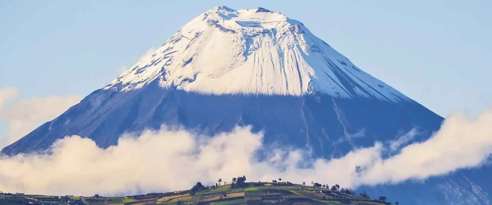
Tungurahua volcano is a 5,023-meter stratovolcano in central Ecuador that erupted continuously from 1999 to 2016. It sits directly above the tourist town of Baños de Agua Santa, about 3.5 hours south of Quito. As of 2026, Tungurahua volcano remains on low-level monitoring with no current eruption activity, per Ecuador’s Instituto Geofísico (IGEPN), and Baños is completely safe to visit.
During the 2006 eruption, people stood on the Ojos del Volcán mirador watching pyroclastic flows light up the night sky — terrifying and mesmerizing at once. The town evacuated multiple times over the years, and the locals always came back. That resilience is part of what makes Baños special: Tungurahua volcano shaped this community, literally and culturally.
This guide covers Tungurahua’s current volcanic activity, what the eruption history means for visitors, how Baños became Ecuador’s adventure capital because of (not despite) Tungurahua volcano, and the best ways to see Tungurahua volcano up close.
Pair It With the Galápagos: 9 Day Ecuador & Galápagos Tour
Need to Know
- Country: Ecuador, South America · Type: stratovolcano · Height: 5,023 m (16,480 ft)
- Status: alert level white (IGEPN) — quiet since the last eruption, Feb–Mar 2016
- New: UNESCO Global Geopark designation, April 2025
- Name: “Throat of Fire” in Quichua
- See it from: Baños, 3.5 hours south of Quito — hot springs, swings, and miradores
Tungurahua Volcano Current Status (2026)
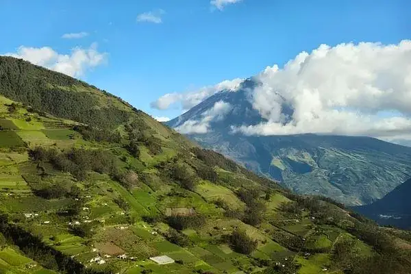
Tungurahua’s last significant eruption was in 2016. Since then, Tungurahua volcano has shown occasional fumarolic activity — wisps of steam from the crater — but nothing that concerns volcanologists. The Instituto Geofísico monitors it 24/7 from their observatory in Guadalupe, just 12 km north of the crater.
The alert level has stayed at white (lowest) since late 2016 — the Instituto Geofísico (IGEPN) status page confirms normal background activity, no restrictions, and zero risk to Baños or surrounding communities. Their official outlook: a new reactivation is not anticipated in the short or medium term. The monitoring network includes seismographs, GPS stations, and infrasound sensors that would detect any change weeks before an eruption.
Should you worry? No. The monitoring system proved itself during the 1999-2016 cycle — every major event was detected early enough for evacuations. And Baños has the most rehearsed evacuation plan in Ecuador. Even local schoolkids know the drill.
Tungurahua Is Now a UNESCO Global Geopark
In April 2025, UNESCO designated the Tungurahua Volcano Global Geopark — recognition that this landscape of craters, canyons, waterfalls, and hot springs has world-class geological value. It’s the reason the volcano keeps popping up in news quizzes and exam papers lately, and it’s good news for visitors too: geopark status pushes better trail signage, local guide training, and conservation funding.
For quick reference: Tungurahua is a stratovolcano in Ecuador, South America, 5,023 m (16,480 ft) tall, last erupted February–March 2016, current alert level white, and the name means “Throat of Fire” in Quichua. That’s the fact set everyone is searching for — now you have it from the town that lives under the mountain. Locals simply call it the Throat of Fire volcano, and after 2006 nobody questioned the name.
Tungurahua Eruption History: The Throat of Fire Volcano
“Tungurahua volcano” means “Throat of Fire” in Kichwa — and the volcano earned that name over centuries of eruptions. The historical record goes back to 1534, with major eruptions in 1773, 1886, 1918, and the extended 1999-2016 cycle that put it on the international radar. Not sure where this fits in your itinerary? Send us your dates and we will sort the order out.
The modern Tungurahua eruption story begins in 1999. The 1999 reactivation started with increased seismicity in September. By October, authorities ordered the evacuation of Baños — 25,000 people left. The town stayed empty for months. When residents finally broke through military barriers to return in January 2000, they found their homes ransacked (not by the volcano, but by looters). That event left a deep mark on the community.
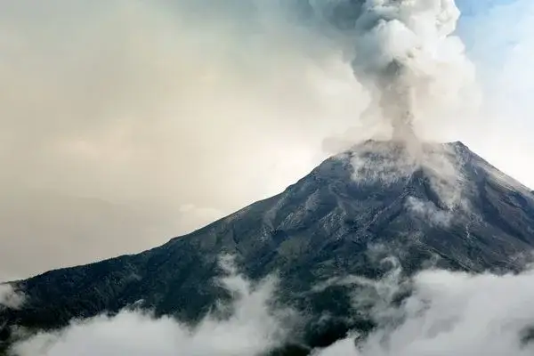
The most intense phase came in August 2006. Pyroclastic flows raced down the flanks at night, reaching within 7 km of Baños. Five people died — all in areas they’d been told to evacuate. Ashfall reached Ambato, Riobamba, and even Guayaquil on the coast.
From 2007 to 2016, eruptions came in pulses. Some months quiet, others with Strombolian explosions visible from Baños at night. Locals got used to it. Hotels kept operating. Tour companies sold “volcano watching” excursions. It became part of the destination’s identity.
Tungurahua Volcano Last Eruption: February–March 2016
The Tungurahua volcano last eruption ran from February 26 to March 16, 2016 — ash plumes, minor pyroclastic flows, and then silence. That event closed the 1999–2016 eruptive period, and the crater has limited itself to occasional steam ever since.
Baños de Agua Santa: The Town Under the Volcano
Baños sits at 1,820 meters elevation, just 8 km from Tungurahua’s crater. That proximity seems dangerous, but the town is actually protected by a natural ridge that deflects pyroclastic flows toward the uninhabited northern and western flanks.
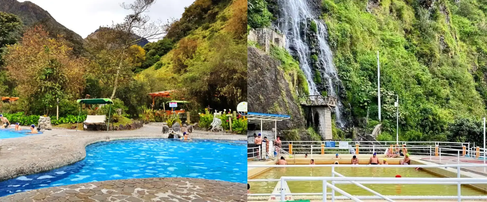
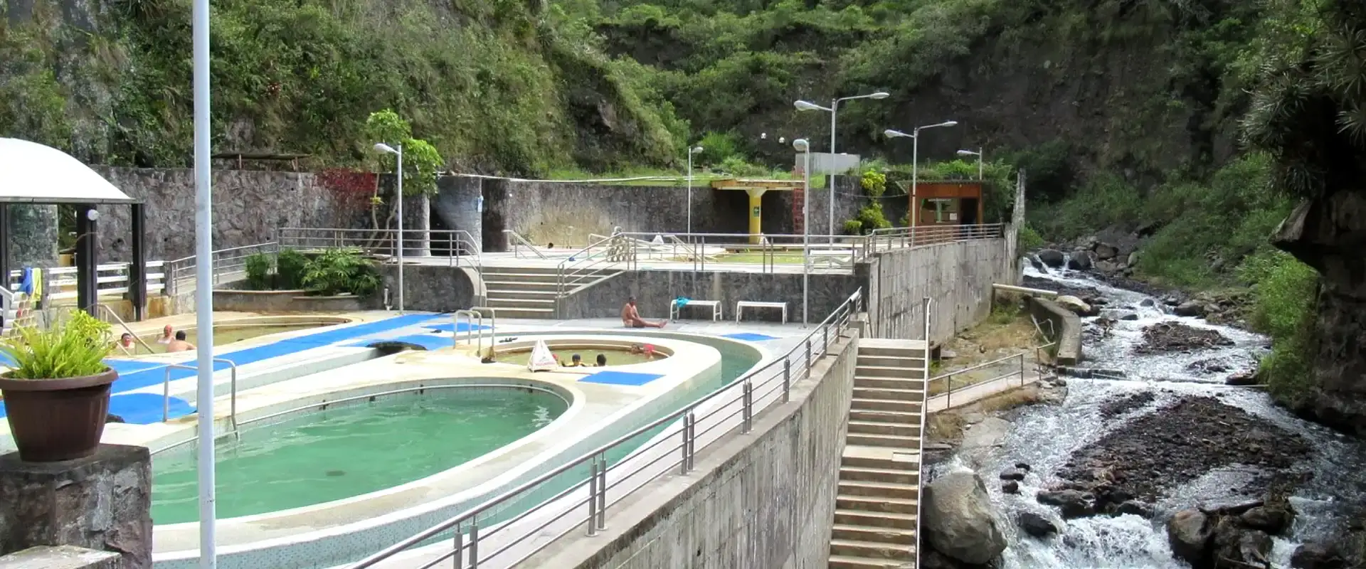
The hot springs that give Baños its name (“baths”) come directly from Tungurahua’s geothermal system. The main public baths — Piscinas de la Virgen, Termas El Salado, and Santa Ana — pump out volcanically heated water between 42°C and 55°C. You’re literally soaking in water heated by the magma chamber below.
Baños has become Ecuador’s adventure capital partly because of the volcano. Where else can you go canyoning in the morning, soak in volcanic hot springs at lunch, and watch a potentially active volcano glow at sunset? The town offers zip-lining, rafting on the Pastaza River, the famous Ruta de las Cascadas bike ride, and the Casa del Árbol swing — all with Tungurahua volcano as the backdrop.
Best Viewpoints to See Tungurahua Volcano
The classic viewpoint is Mirador Ojos del Volcán (also called Mirador de Bellavista), about 25 minutes by car from Baños center. On clear mornings — usually before 9 AM — you get an unobstructed view of the entire cone. During the eruption years, this was the spot where photographers captured those iconic nighttime shots.
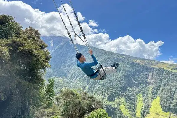
Casa del Árbol in Runtún is famous for its swing over the void, but the real draw is the volcano panorama. You’re at 2,660 meters here, almost eye-level with Tungurahua’s flanks. Go early before the clouds roll in.
From Baños itself, the best in-town viewpoint is the path up to Mirador de la Virgen — a 15-minute uphill walk from the church. Locals come here at dusk for the light.
Hiking Around Tungurahua: Routes and Safety
You can’t hike to Tungurahua’s summit — the exclusion zone remains in effect above 3,800 meters. That’s been the rule since 1999 and it’s unlikely to change anytime soon. But there are excellent hikes in the lower slopes and surrounding area.
The Runtún to Pundoa trail (about 4 hours round trip) takes you through cloud forest and farmland with constant volcano views. Start from Runtún village and follow the ridge trail heading south. No guide needed, but bring rain gear.
For something more ambitious, the Pondoa to Chontilla trail follows an old evacuation route along the Vazcún River canyon. About 6 hours, moderate difficulty, and you’ll pass through some of the areas most affected by the 2006 eruptions — you can still see the lahar deposits.
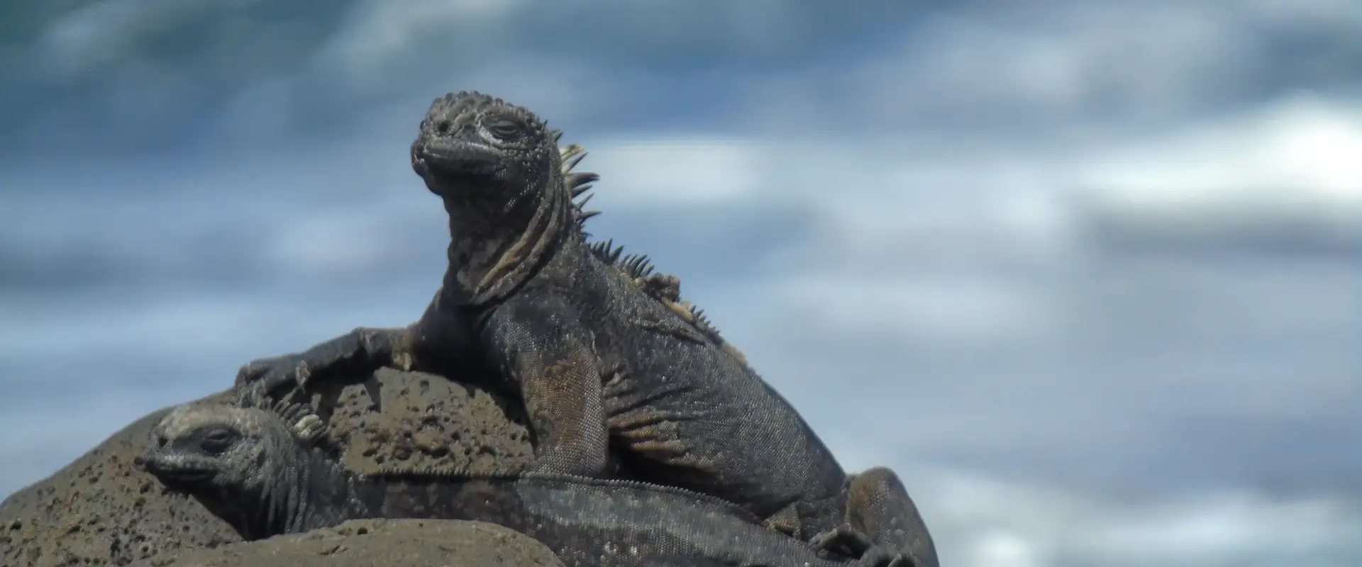
START IN QUITO, END IN THE GALÁPAGOS
9 Day Ecuador and Galapagos Tour: Andes, Amazon and Santa Cruz
Quito, Cotopaxi, Quilotoa, Baños and the Amazon with your own guide, then three nights on Santa Cruz with tortoises, beaches and snorkeling.
From $1,990 per person
View itineraryHow to Get to Tungurahua From Quito
From Quito, take a bus from Terminal Quitumbe to Baños — the ride is 3.5 hours and costs $5-6 with Transportes Baños or Expreso Baños. Buses leave every 30 minutes from 5 AM to 10 PM. You can also drive via the E35 highway through Ambato.
From Baños, Tungurahua volcano is literally the mountain looming to the south. To reach the viewpoints, hire a taxi ($5-8 to Ojos del Volcán) or rent a bicycle and ride up — it’s steep but doable.
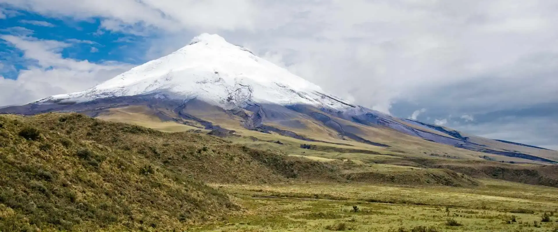
Combine Tungurahua volcano with a stop at Cotopaxi National Park on the way — it’s a natural route along the Avenue of the Volcanoes.
Want the volcano route without the bus logistics? A guided multi-day covers Baños, Quilotoa, and the highlights in one go.
Tungurahua Volcano Ecuador: Where Exactly Is It?
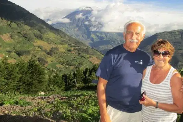
Tungurahua volcano, Ecuador (Volcán Tungurahua in Spanish) stands in the centre of the country, in Tungurahua province, about 140 km (87 miles) south of Quito and just 8 km south of the town of Baños de Agua Santa. It sits on the eastern edge of the Ecuadorian Andes at coordinates 1.467° S, 78.442° W, marking the transition from the Andean highlands to the Amazon basin.
The volcano rises to 5,023 meters (16,480 feet) above sea level — the 10th-highest active volcano in the world — and dominates the skyline from every direction. Tungurahua volcano is part of the Cordillera Oriental (Eastern Range) of the Andes, which Ecuadorians call the Avenue of the Volcanoes, a 200-km corridor containing more than 20 active or potentially active volcanoes.
Administratively, Mount Tungurahua volcano lies at the borders of Tungurahua volcano, Chimborazo, and Morona Santiago provinces. The nearest major cities are Ambato (33 km northwest), Riobamba (30 km southwest), and Baños (8 km north) — the tourist hub built directly on the volcano’s lower flanks.
Interesting Facts About Tungurahua Volcano
One interesting fact about Tungurahua comes before all the others: the name Tungurahua volcano comes from Quechua: tungur (throat) + rahua (fire) — literally “Throat of Fire.” Locals also call it Mama Tungurahua (Mother Tungurahua) and believe she is married to neighboring Mount Chimborazo — with Cotopaxi as the jealous suitor.
Tungurahua’s eruption cycle runs roughly every 80–100 years. Major eruptions are recorded in 1773, 1886, 1916–1918, and 1999–2016 — the most recent 17-year active phase produced spectacular Strombolian explosions, nightly lava fountains visible from Baños, and ash fall that reached Quito.
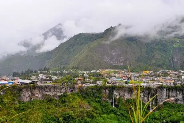
Despite all that activity, Baños was never destroyed. The town sits in a valley slightly off-axis from the main eruption pathways, and residents refused to permanently evacuate even during the worst of the 2006 eruption. Today Baños is a thriving spa town of 20,000 people and Ecuador’s top adventure tourism hub — a direct consequence of the volcano’s thermal springs and dramatic terrain.
Does Ecuador Have Other Active Volcanoes?
Yes — Ecuador has 8 officially active volcanoes on the mainland plus 3 more in the Galápagos. The country sits on the Pacific Ring of Fire, and the Instituto Geofísico (IGEPN) actively monitors all of them. Beyond Tungurahua, the most notable active volcanoes near Quito are:
- See the 2-Day Baños Trip (5,897 m) — the most famous, last erupted 2015, 50 km south of Quito.
- Reventador (3,562 m) — continuously active since 2002, in the Amazon cloud forest east of Quito.
- Sangay (5,230 m) — Ecuador’s most consistently active, 40 km south of Tungurahua, currently in a 2019-present eruption cycle.
- Cayambe (5,790 m) — the only glaciated volcano on the equator, dormant but potentially active.
- Chimborazo (6,263 m) — Ecuador’s tallest peak, last erupted ~550 BC, officially “potentially active.”
For visitors, the easiest active volcanoes to see from a distance are Cotopaxi (from Quito on a clear morning) and Tungurahua (from Baños). Climbing any of them requires a certified guide and acclimatization — both Cotopaxi and Chimborazo are glaciated and need full mountaineering gear.
When Will Tungurahua Erupt Again?
Nobody can predict exact eruption dates, but Tungurahua’s pattern of 80–100 year active cycles followed by decade-long dormant phases suggests the current quiet period (since 2016) could continue for another 20–30 years before the next major activity. That said, smaller phreatic explosions or ash emissions can happen at any time with days or hours of warning.
The Instituto Geofísico de Ecuador (IGEPN) operates a permanent monitoring network on Tungurahua — seismometers, tiltmeters, gas sensors, and webcams. In the event of reactivation, alert levels go from White (normal) through Yellow, Orange, and Red, with Baños emergency protocols honed over three decades. Current alert level: White.
For visitors, this means: check the IGEPN daily bulletin before traveling to Baños, follow local evacuation routes (they’re posted everywhere in town), and know that tour operators, restaurants, and hotels all have active safety plans. The volcano is closely watched — you won’t be caught off guard.
And since you’re already planning around Ecuador’s volcanoes: most travelers pair the highlands with the islands. A set Galápagos itinerary out of Quito makes the two-world trip surprisingly simple.
Quick Answers: Tungurahua Volcano
Quick answers to the Tungurahua volcano questions people ask most — travelers and trivia-hunters alike.
Is Tungurahua volcano active right now?
Tungurahua is classified as an active volcano but is currently in a quiet phase. As of 2026, the IGEPN (Geophysical Institute of Ecuador) maintains the alert level at White (background activity) with only minor fumarolic emissions at the summit. The last eruptive phase ended in March 2016, and the volcano has shown no signs of reactivation. Baños and surrounding communities remain safe for tourism.
What are some interesting facts about Tungurahua volcano?
Tungurahua means “Throat of Fire” in Quechua and is affectionately called “Mama Tungurahua” by locals. It stands at 5,023 meters (16,480 ft), making it the 10th highest active volcano in Ecuador. It has erupted in cycles of roughly 80-100 years throughout recorded history, with major eruptive phases in 1773, 1886, 1916-1918, and the most recent 1999-2016 cycle that lasted 17 years. Its glacier-capped summit lost most of its ice during the 1999+ eruptive phase.
Is it safe to visit Baños with Tungurahua volcano nearby?
Yes, Baños is completely safe to visit. The town has been safe since the eruption cycle ended in 2016, and even during active eruption periods the tourist zone was evacuated proactively only when IGEPN raised alerts. Baños is located on the northern side of Tungurahua, outside the main lahar and pyroclastic flow paths. The town has a comprehensive early warning system, designated evacuation routes, and SOS sirens — making it one of the most volcano-prepared towns in Latin America.
Where is Tungurahua volcano located?
Tungurahua is located in the Eastern Cordillera of the Ecuadorian Andes, about 140 km south of Quito and 33 km southeast of Ambato. Its GPS coordinates are -1.467°S, -78.442°W. The volcano sits inside Sangay National Park (a UNESCO World Heritage Site) and rises dramatically above the town of Baños de Agua Santa, Ecuador’s adventure tourism capital.
Can you climb Tungurahua volcano?
Not to the summit. The summit exclusion zone above 3,800 meters has been in place since 1999 and remains enforced. However, you can hike to the Pondoa refuge at 3,800 m with a certified local guide — a 5-6 hour round trip offering spectacular views of the crater and Baños valley below. Independent climbing above the refuge is prohibited.
When was Tungurahua’s last eruption?
The last significant eruptive activity occurred in March 2016, ending the 1999-2016 eruption cycle. Since then, the volcano has shown decreasing activity with only occasional minor ash emissions in 2017-2018 and sporadic fumarolic degassing thereafter. IGEPN has maintained a White alert level since 2019.
Does Ecuador have other active volcanoes besides Tungurahua?
Yes. Ecuador has over 27 potentially active volcanoes, of which 8 are currently monitored as active by IGEPN. The most notable include Cotopaxi (5,897 m, mildly active), Reventador (continuously erupting since 2002), Sangay (in near-continuous eruption), Cayambe, and Chimborazo. Ecuador sits on the Pacific Ring of Fire, making it one of the most volcanically active countries per square kilometer on Earth.
Will Tungurahua erupt again in 2026?
Volcanologists cannot predict exact eruption dates, but IGEPN currently shows no precursor signals (no seismic swarms, no significant inflation, no anomalous gas emissions) suggesting an imminent eruption in 2026. Tungurahua’s historical pattern of 80-100 year cycles suggests the current quiet phase could last decades. The volcano is monitored 24/7 with seismometers, tiltmeters, and gas sensors — any changes would trigger alerts well in advance.
Is Tungurahua a UNESCO Global Geopark?
Yes — UNESCO designated the Tungurahua Volcano Global Geopark in April 2025, recognizing the volcano, its canyons, waterfalls, and hot springs as a landscape of world-class geological value. It’s the reason Tungurahua keeps appearing in news round-ups and exam questions.
Before You Go
- Check the IGEPN status page before your trip — alert level white means all clear
- Base yourself in Baños: hot springs, the swing, and the best miradores
- Clear mornings beat afternoons for volcano views — go early
- Bus from Quito (Terminal Quitumbe) ≈ 3.5 hours, or join a guided route
- Want the photo everyone wants? Casa del Árbol swing with the cone behind you
Tungurahua’s story is really the story of Baños — a town that learned to live with one of Ecuador’s most active volcanoes and turned it into a tourist attraction. The eruption cycle is over (for now), the hot springs are flowing, and the views are as dramatic as ever. Volcanology nerds, adventure-sport addicts, and hot-spring soakers all get their fix here with a volcano in the background, Tungurahua delivers.
For more Ecuador volcano adventures, explore our guides to climbing Cotopaxi, discovering Chimborazo, and the full guide to all 84 volcanoes in Ecuador.